As usual, for those who missed out on the latest infrastructure safari, here it all is in an armchair edition that you can ride through in Google Maps in the unlikely event that you’ve got nothing better to do:

As usual, for those who missed out on the latest infrastructure safari, here it all is in an armchair edition that you can ride through in Google Maps in the unlikely event that you’ve got nothing better to do:

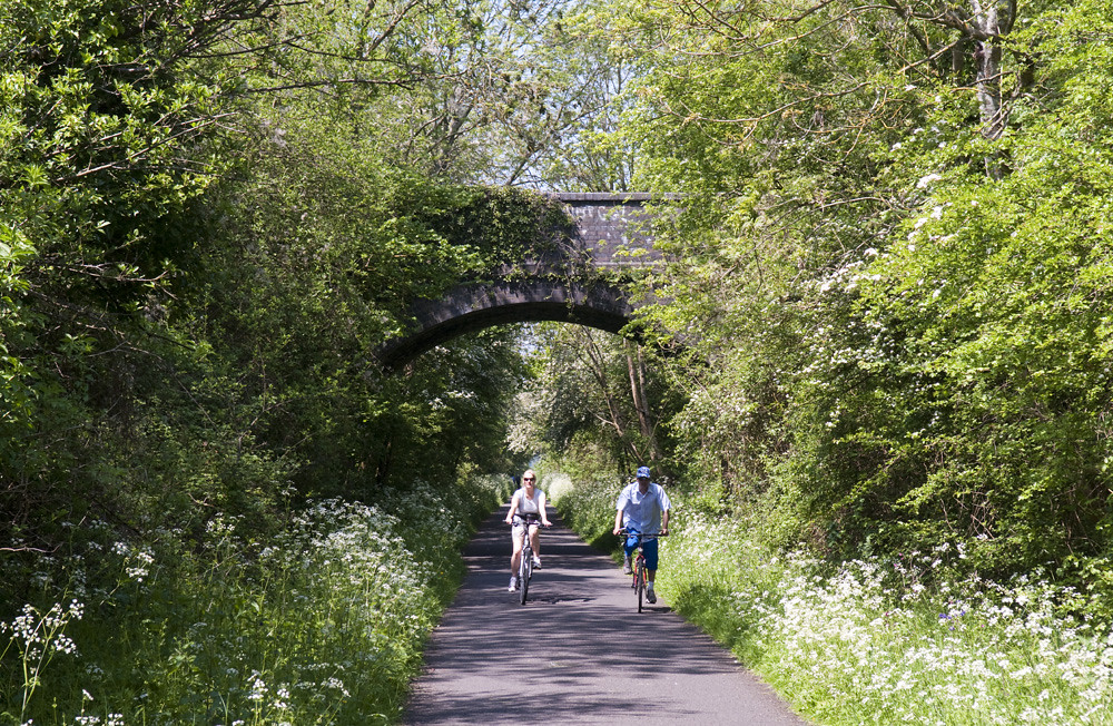
Don’t forget folks, it’s only just over a week ’till our nice relaxing bicycle ride to the beaches of Weymouth and Portland. On the morning of Saturday 18th we’ll gather in Dorchester ready to follow the 12km (7.5 mile) Olympic cycleway to the seaside, and then perhaps have a look at some of the other infrastructure in the town.
The original plan was to meet at Dorchester South station for the 11:52 arrival from Waterloo, but due to requests from those with connections, we’ll hang around just long enough (and not a second longer — we’ve a lunch at the seafront to get to!) for those on the 12:04 arrival to join the back of the pack as we set off. That’ll also give loads of time for those travelling from Bristol/Bath to make the short journey over from Dorchester West station.
If anyone arrives significantly earlier than the meeting time, they’ll probably find me just around the corner checking what’s on offer in the newly redeveloped brewery… perhaps not the new flats, though: even with the excellent advertising line they’ve taken, I’m not sure who’s going to be paying £1.25 million for a flat in Dorchester… I mean… Dorchester…


Back in August, Jim led a successful seaside safari in Worthing and Brighton, on which we looked at the good, the bad, and ugly bits of south coast infrastructure for cycling… while, of course, having a nice leisurely bicycle ride beside the beach in the sunshine.
Despite the latest easterly’s feeble attempts at bringing us one last delivery of snow and ice, it can not be too long before we have to start thinking again about days out on the south coast. I am therefore proposing a seaside safari to Britain’s sunniest town and original seaside holiday resort: Weymouth.

Weymouth could be an interesting little case study for infrastructure: a somewhat smaller town than those we’ve visited on previous safaris, with the inter-urban Olympic cycle track on the main road into the town and, like Bristol, a growing network of away-from-road multi-user paths, including the Rodwell Trail railway path. It also has some infrastructure on hills.

I’m proposing Saturday 18th May (while folk at the other end of the island are Pedalling on Parliament), meeting at Dorchester South at 11:52, for the (6 full-size bicycles per train) arrival from Waterloo. Folk travelling from or through Bristol would arrive five minutes earlier a couple of hundred yards away at Dorchester West. We’d spend an hour or two — depending on how fascinated everyone is by the infrastructure design — covering the 7.5 miles / 12 kms of mostly traffic-free route to the sea front for lunch, followed by options for further rides (probably the Rodwell Trail out to Portland Harbour and Chesil Beach), ending at a pub near to Weymouth station, or else the option for folk to split off for their own family afternoons with the Punch and Judy shows on the beach.
But that’s only if enough people express an interest. Is anybody interested?
Update: I have had sufficient interest here and on twitter/email/etc to give the go ahead exactly as described above. And cheap advance train tickets have just gone on sale today. If you want to reserve bicycle spaces with your ticket, I’d buy from the East Coast website. Though those with railcards (including the Network Card) might find that a flexible walkup ticket is not a bad deal on the weekend.

In January I said some nice things about the Caledonia Way, what is shaping up to be a very nice leisure (and perhaps, for some locals, plain utility) ride between Oban and Fort William, via Glencoe. I never got around to writing the other half of the story: the road to the isles. I don’t really have any interesting point to make about it, it’s just an excuse to post pictures of pretty places and crap cycle tracks.![]() Continue reading “The crap cycle facility to the isles”
Continue reading “The crap cycle facility to the isles”

Finally, the Saturday evening Infrastructure Safari at the Cycling Embassy’s AGM in Bristol in May. This was led by Steve Melia, a transport and town planning academic at the University of the West of England and campaigner from the Carfree UK and Living Heart for Bristol campaigns. That latter campaign formed the theme for the safari, a short ride around the city centre looking at the big roads that blight it and the ways in which traffic reduction has already helped to make a more thriving liveable city, and the potential for further reduction.
The basic idea of the Living Heart campaign is to cut traffic and create a liveable city centre through the careful use of selective permeability to make it impossible to drive through the city centre, without preventing anybody who has a genuine need to be there with a vehicle — residents, traders, and deliveries — from driving in and out. In a sense, they are seeking to make the best of the Bristol that the motorway mad 1960s planners left us, with its arterial motorway and inner ring road, by switching from a system which used the big roads to feed ever greater volumes of traffic into the old city streets to one which uses those main roads to remove traffic from those streets. Or, to put it another way, they would block up the ratruns, freeing them up for more suitable and useful purposes.

Compared to much of the country (and I know, that’s hardly a ringing endorsement), Bristol already has a relatively good record on creating a liveable low-traffic city centre. It started in the 1980s with strategic road blocks and short sections of pedestrianisation to close ratruns in the Old Town, at King Street and Corn Street and the like, and continued in the Broadmead shopping area with (poorly enforced) bus-only streets coupled to one-way systems which enable access while making unattractive ratruns. More dramatically and famously, Bristol has succeeded in rolling back some of the mistakes of the motorway mad past: the inner “ring” road dual carriageway isn’t a ring any more. Where for decades it crossed diagonally through the fine Georgian Queen Square, blighting the area so that all around was neglected and run down, it was closed amid much protestation in the mid-1990s, and the square restored in stages through the 2000s, giving the city a much loved little park and thriving commercial zone. Similarly College Green outside the cathedral has lost a main road.
But the city centre still suffers from motorists trying to find a shortcut through the old streets, at times making them unpleasant places to be and to do business, and trapping pedestrians, cyclists and public transport users in the mess they create, not just fellow motorists. The campaign are not greatly attached to any one specific means of keeping this through traffic out of these unsuitable streets — there are lots of potential places where a block or a bus gate would be appropriate and have the desired effect. But they particularly point to the four bridges that cross the harbour within their ring road cordon as obvious places to consider.
And they have a good local example to cite. Unfortunately we were too busy looking at railway paths to look at the city centre while in Bath. At first sight Bath, with a perpetually jammed trunk road almost through the heart, would seem an unlikely choice for a lesson on liveable low-traffic city centres, but it would have been worth looking at for the ways in which many of the old city centre streets have been reclaimed from traffic while maintaining essential access: through road blocks with pedestrian and cycle permeability, a one-way system around the historic and commercial centre which enables access for delivery vans and then sends them back to the same main road they came in on, and, of interest to Living Heart, Pulteney Bridge bus gate. Together these things create some pleasant public spaces, some streets fit for cycling, and some bus routes not completely blocked by jams of ratrunning motorists.
Ultimately the Living Heart campaign, and Steve’s safari, is about segregation: separating traffic away from people. It’s what all of the diverse safaris in the Westcountry were ultimately about. Which will be explored properly in a post to conclude this whole thing. If and when I get around to writing it…

Another of the Embassy AGM Infrastructure Safari writeups. Shorter and not quite so nerdy: a scenic circuit of the lower section of the former docks in the evening sunshine, including a Victorian-era riverside shared path, a huge incongruous 1960s road system beside the Clifton Suspension Bridge viewpoint, and another example of Bristol turning roads into parks. The main point, though, was that the old quaysides and riverside paths, despite all their limitations, make usable and even pleasant (if you’re not in a hurry) cycle routes, linking up to the other traffic-free routes, and perhaps help to explain Bristol being that fraction better than the rest of the country at widening access to cycling.

I promised to write up the other infrastructure safaris that the Cycling Embassy took while in Bristol for the AGM in May. David Arditti blogging about the safaris prompted me to get on with it. Previously I showed you the Railway Path. Left to come are a couple of rough and rambling posts, accompanied by Google Earth infrastructure safaris, on Bristol’s arterial cycling infrastructure (below) and city centre streets, hopefully leading to the properly thought out post that will eventually get to the point.
So on the Sunday morning safari we looked at the options for utility cycling between the city centre and residential and commercial neighbourhoods in the north of the city.
As before, for the details, pictures (mostly Mark’s and David’s) and video, it’s recorded as a virtual tour to be taken in Google Maps or downloaded for Google Earth: here is the Google Map tour.
The basic context is that we rode from the city centre through 5km of residential neighbourhoods until we hit the outer ring road. The latter is late 20th century car territory — motorway junctions sending out tentacles of dual carriageway distributor roads to roundabouts around which car oriented commercial development grows. Much of the British aerospace industry, a major Ministry of Defence office, retail and logistics businesses, offices and R&D for tech companies, and a large university rise from a sea of car parks out here in the “North Fringe”, just outside the city boundary in South Gloucestershire, where the council allows that sort of thing. The route we were looking at was therefore one of important traffic flows: two centres of employment (and culture and retail and education) and the residential neighbourhoods they serve.
There are several different arterial routes serving this traffic: of road, rail and cycleway. We headed north on the original artery — the traditional main road, the A38 Stokes Croft/Cheltenham Road/Gloucester Road (turning off onto the lesser Filton Avenue for a shortcut). Just a normal British urban arterial ‘A’ road, 2 lanes + 2 bus lanes where room permits, dozens of buses in peak hours, car parking in the off peak hours, row upon row of shops and houses and little residential side roads. Occasional token painted 1.2m advistory cycle lanes, of no use to anybody under the parked cars.

We headed back on a new Cycling City funded cycle route, Concorde Way, on about 50:50 residential backstreets and 3.0-3.5m shared paths. The route is not bad. Nowhere near modern Dutch standards, obviously. There are a couple of little fiddly bits with toucans and pavements. There’s a street that’s used by motorists as a ratrun. There are paths as narrow as 3.0m shared between pedestrians and cyclists, despite this being a densely populated urban area. There are paths even narrower than that, briefly, where they reuse the 1970s subways under a motorway junction. There’s a new home zone built on a through trunk cycle route. I wish it were better, but I congratulate its designers for doing so well against all the odds, fighting the rules of British Highways engineering all the way. Aforementioned pinch points aside, it’s not too narrow, it’s not too slow, it’s not too unsafe, it doesn’t ever abandon you. It has advantages, like avoiding all the traffic signals you get on equivalent main roads. It’s a 5km cycle route that works the whole way, and which is enabling people who would not otherwise get around by bicycle to do so, while at the same providing a route that confident and speedy cyclists won’t turn their noses up at.
In that sense, this might look a bit like a case of unravelling routes: putting the cars somewhere else, where they can’t bother the people on foot and on bicycles.
But that this is far from having been satisfactorily achieved is illustrated by the fact that that there are at least as many people on bicycles on the old main road as there are on the dedicated cycle route. Because the cycle route’s one really big flaw is that it isn’t where most people want to be. It runs through a park by a river, through allotment gardens beside the railway cutting, across the wasteground underneath the electricity transmission lines and past the rugby practice field. Politically easy to achieve and physically easy to build, in places where there is little competition for the space. Whereas the main road runs past the shops, and the offices, and all the houses.
And so it appears that this is less like unravelling routes and more like dual networks: the idea that if you just put a basic cycle route on back streets and traffic-free paths to enable children and the less confident to train themselves up, eventually they become confident enough to man up and take the lane with the trucks and buses on Cheltenham Road. The difference is that in most other cases, the quality of the cycling infrastructure is cut to a bare minimum and then cut some more (because it’s just a training network, so what do things like directness and speed and comfort and capacity and actually going somewhere matter?), whereas this one is genuinely good and useful and nice, if you happen to be going in that direction.
It’s great that Bristol has built this, and the several other similar new arterial cycle routes. I don’t blame them for going for this stuff instead of the main roads at this point in time. It’s the politically easy low-hanging fruit of paths across parks, derelict railway corridors and wasteland; and the relatively cheap quick wins of filtered permeability and little paths and bridges here and there to join up riverside paths and quiet streets into longer routes. Of course you’d do those things first.
But the lesson from the Netherlands — who did all the experiments for us, decades ago — is that routes like these will only buy you so much modal shift, and they can’t deliver a whole Cycling City. For most people, if the cycleway doesn’t go where they’re going, they won’t cycle. What really starts to deliver impressive numbers is enabling cycling for all, not just the unusually confident and tolerant few, to ride on that main road, the one where the shops and the offices are, the one with all the residential streets running off it. And what really makes a Cycling City is not routes but a network: if people are to routinely pick the bicycle over the car without thinking or planning, they need to be confident that whatever their journey, especially those to places they’ve never been by bicycle before, they’ll be able to just get on and go without fear of being dumped in traffic on a dual carriageway or multi-lane roundabout.
There is one more artery in this story: the M32 motorway. I wrote about it before — how parks were paved over, railway viaducts blown up, and inner city neighbourhoods bulldozed as it was thrust into the heart of the city. After all the destruction it brought in its path, the final tragedy was that, far from being designed to relieve the old arteries and streets of traffic, allowing the likes of Gloucester Road to be reclaimed from the passing motorist by its residents and shoppers, the motorway was designed to pump an ever greater volume of traffic onto those streets. But it would not be at all difficult to start fixing that mistake — to reclaim the space needed for cycling on the main arteries by sending motorists to the motorway. Which is the point I’ll get to in a future post.


The Cycling Embassy went to Bath and Bristol for the AGM, and around the discussion and decisions for the future, we had fun riding around a couple of my favourite cities pointing at the nerdy details of the infrastructure, seeing if there was anything to be learnt about what to do and what not to do. I promised to do write-ups of them, and decided to experiment with using Google Maps as a medium for doing a photo essay tour.
Link to the Google Maps photo essay tour.
You can take the tour by going through the pins in the left-hand panel, clicking them in turn to open the bubble with the information about each point of interest; alternatively, hide the panel, set your browser to full screen mode, zoom in at the Bath (eastern) end of the yellow line and start following it west, clicking the bubbles in turn for the information (some of them can be easy to miss when zoomed in, though). Or for a third option, click on the “KML” link to open it in Google Earth for easier zooming and panning around.
I prepared a lot of photos in advance (and then failed to prepare a blog post in advance), but didn’t manage to get everything. Thanks to As Easy As Riding A Bike and A Grim North for capturing all the photos that I’d failed to get.
If you like the format, I’ll do the other Safaris that way too.

Another quick update on a Scottish cycle route, before I post my conclusions about them. This is the Caledonia Way, NCN78, a 350km route from Campbeltown and the Mull of Kintyre up the Argyll coast to Oban, alongside the sea lochs to Fort William, and up the Great Glen to Inverness. The Caledonia Way is being developed primarily to be a great all abilities tourist trail (though with uses as a serious local transport route), linking some great Highland landscape to the railway towns via a relatively flat route.
The intention is for the route to be on dedicated cycle paths and tracks throughout, except a few short sections where existing suitable very quiet lanes and streets exist. This is, of course, a similar aspiration to that of the National Cycle Network, but one that sadly hasn’t always worked out quite as intended.
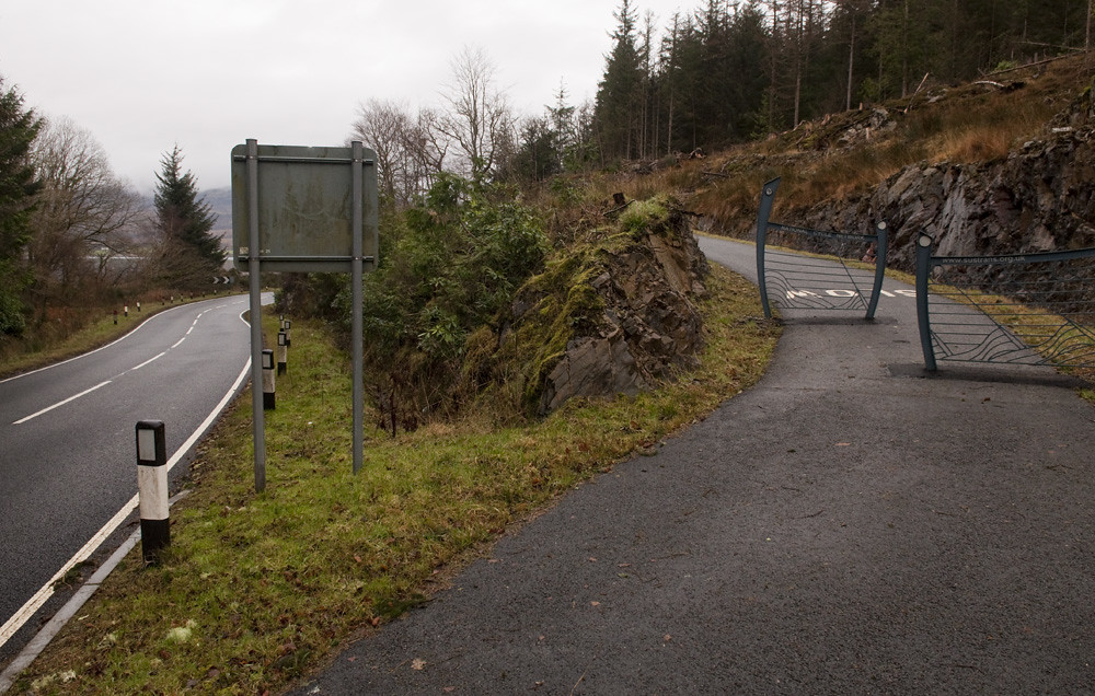
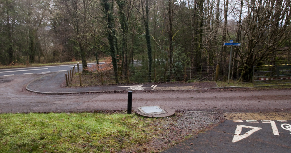
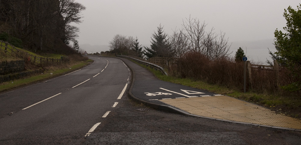
But the Oban to Glencoe section shows how the Caledonia Way is doing. Here, the cycle route runs alongside sea lochs, going the same way as the A828, a non-trunk primary route which is not very busy but is in many places engineered for very high speeds. Over the past few years the road has been acquiring cycle tracks. The organisations involved have not compromised on acquiring the amount of land that is required to build something on which you can pass, overtake and ride three-abreast:
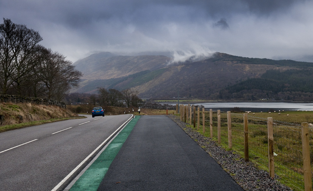
Nor do they seem to have compromised on building all of the foundations, drainage and other structures that the route needs:


Here, where the road went into an existing wood, the path has been threaded further back from the road, hiding the traffic a little…
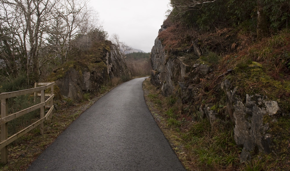
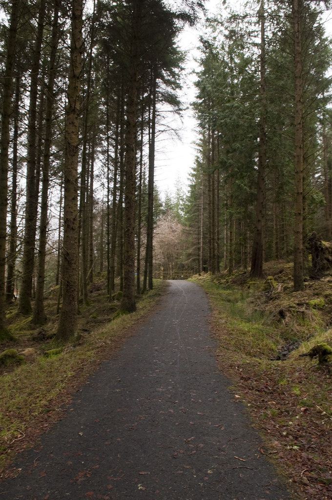
…but for much of the route cyclists don’t have to follow the road at all. The old Oban to Ballachulish railway also ran along here, and the cycle route has taken over the trackbed for several miles in a couple of different places:
 |
 |
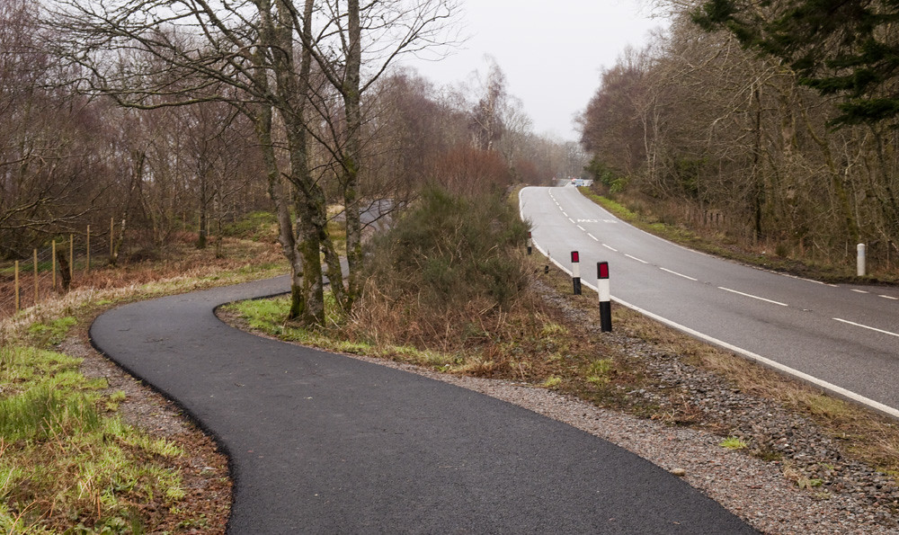
Sometimes it doesn’t follow road or railway, but takes its own paths of least resistance:

There are a couple of places where the cycle tracks briefly get nasty. But the designers have at least proved that they understand what “minimum standard” means: the bare minimum which can be acceptable for those few yards where the expense of engineering out the geography would be unreasonable, not the sustained standard at which to build the whole route.
 |
 |
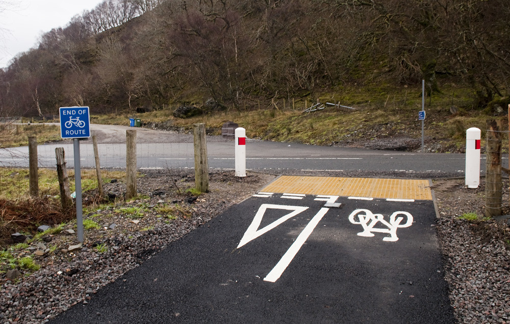
Sadly there have been a couple of really embarrassing prioritisation decisions, involving a (disused?) gated quarry road and one really very unfortunate little mess at a driveway (I’m hoping that this mess, which is next to the pinch-point above left and is only a short section of poor quality tracks between good quality railway paths, is just an interim link before something better can be done using the railway).
 |
 |
But, on the new tracks and paths, those are the most notable issues in the 50kms between Oban and Glencoe. That is, on the new tracks. There are some at the Oban end that are several years older, and are your typical 2.0m pavement construction. I hope it’s not too late for those to be revisited by the new designers, who clearly have a better idea what they’re doing…
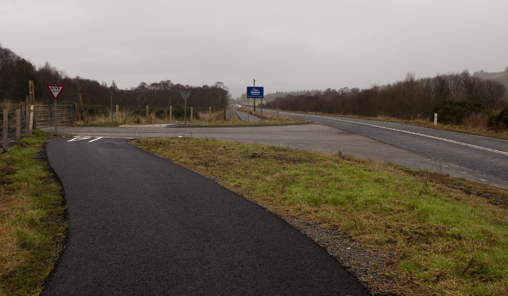
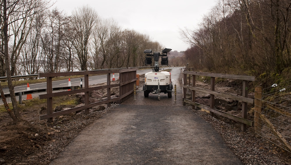
But it’s not too late for everything to go wrong. Only a little over two thirds of the tracks and paths to bypass the A828 have been built so far, often leaving you back on the main road:
 |
 |
Though Irish Navvies (no really, the contractor’s trucks had IRL plates) are out there right now building more of it (and the progress since I rode it in the spring almost two years is immense):
And Oban to Glencoe is so far the only section of the Caledonia Way to have been built. Which brings me to my point — or will, when I get around to posting it.
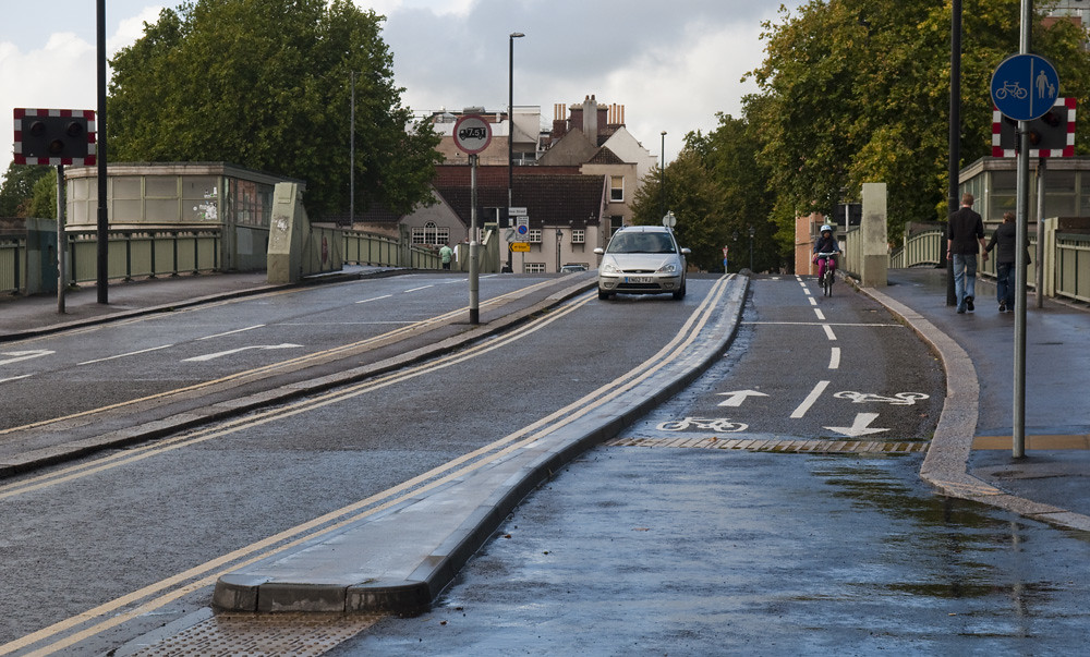
Like most British cities, Bristol has a big inner ring road. It crashes through neighbourhoods of medieval houses and 1970s concrete office towers, and it thunders past landmarks from Brunel’s Temple Meads Station to England’s largest parish church, St Mary Redcliffe, a fortress of fast cars and pedestrian cages cutting the old central business district from the rest of the city.
But it’s not a ring road. The ends used to meet: from Redcliffe church it continued west over the bascule bridge and cut diagonally through the run-down Georgian Queen Square. Twenty years ago, Queen Square was taking 20,000 vehicles a day, including 1,000 buses. No wonder it was run-down. The council got rid of the vehicles, all of them, and restored the Georgian square, now a calm but popular little park. It remains one of the few notable examples of undoing 1950s-80s urban motorway mistakes in the UK, and it happened at the same time as one of the last of the mistakes, the M11 link, was being driven through Leytonstone.

The restoration of Queen Square left a bizarre stub of dual carriageway on Redcliffe’s bascule bridge (orange, below the ‘I’ in ‘Bristol’), carrying a tiny fraction of its designed capacity. When I was there in the spring I noticed that they had finally brought the builders in to do something new with the bridge. Here’s the finished £130,000 piece:

I was a bit disappointed — I’d been expecting them to move on to the other carriageway once this one was complete, for a pair of unidirectional tracks, but they’ve just gone for a bidirectional track using a single traffic lane, which apparently isn’t much help to the gentleman who is using the opposite pavement. Still, the one track is not an unusable width.
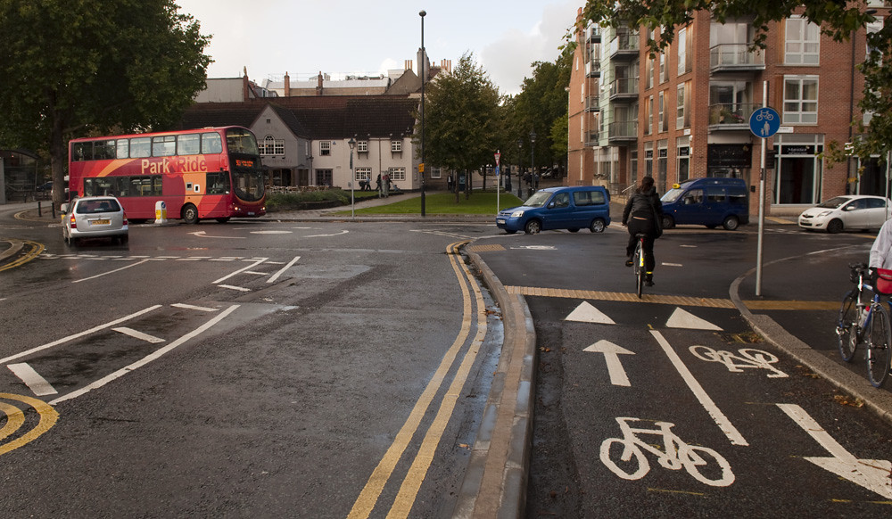
The reason they’ve gone for a two-way track here is that the council are not thinking in terms of fixing individual isolated streets, but nor have they yet got to the stage where they can think in terms of a network. If this were part of a network, you would have tracks on each side linking up to more tracks around the other big roads, as well as to the calmed low-traffic streets around here. Rather, Bristol is currently thinking in routes — that’s all they can do with the small pot of money they were given to become a “cycling city”. This is one of half a dozen routes that the city was able to create with the project.
It’s the “Brunel Mile”, a very direct route between Temple Meads Station to the bars, restaurants, and museums of the old harbour. Sadly, this short section over the bridge is probably the highest quality section. The cycling city website, Better By Bike, produced a video of it:
Lots of shared use plazas, parks, and pavements. That’s fine for access — making it possible to keep riding the final yards to the destination — but shared use doesn’t really make for an attractive through route, especially when it runs straight through a set of tables laid outside a cafe. Bristol already had a lot of shared use squares and parks — Bristolian pedestrians and cyclists seem to be able to get along without one interpreting the mere sight of the other as a near death experience. Little, if any, of the shared use in this video is new, but previously it was designated as shared use more because there was no reason to ban bicycles from those areas, rather than because they made useful through routes.
Bicycles have at least been given priority, and a raised table, where the route crosses Welsh Back, from Queen Square onto the bascule bridge — though there aren’t many other examples of this arrangement in the Westcountry, so it might take motorists a while to work out that their “give way” markings aren’t a mistake (notice that the producer of the video clearly had little confidence that the white van was going to give way at 0:57). And there’s no other priority crossings on the route — only some grey-green paint on Prince’s Street, and toucan crossings with very long waits on three different branches of ring road before finally reaching Temple Meads.

Clearly the cycling city team were going for a cheap option — spreading their little grant thin over as many routes and projects as possible, and reusing as much existing infrastructure, whatever the quality, where they could. But when it came to a gap in their route, where no existing infrastructure could be commandeered, they’ve taken the time and money to do it right: they’ve taken a traffic lane out to built a proper usable cycle track, rather than dump people on a dual carriageway with the buses. Perhaps it’s not quite as much space as would really be desirable, but it’s enough, and with priority over the minor roads. And they did it, so far as I can tell, without being asked — without the campaign and the fight that was required in Camden.
With real funding, I think Bristol could do great things. The cycling city grant must have brought some of the right people in. With the grant all spent, I fear they will have been sent on their way.
 |
 |
The local rag doesn’t like it, but I always got the impression that the Evening Post was pretty irrelevant.

It’s always sad to see a town’s residents asking for a bypass, citing the fact that their town centre is choked with traffic. Here’s some traffic heading south out of Dorchester, county town of Dorset, about to cross over the 1980s bypass and onto the main road to the seaside resort of Weymouth, six miles and a big chalk hill away. It’s as much traffic, or more, as there was before the bypass was built.* Continue reading “Weymouth: on the right track, and the road to nowhere”
While touring the hills of England and Scotland a month ago, I briefly stopped off again in Glasgow. I think they must have read my blog and been shamed into action. Look how the city has changed in just six months!
This is new:

This is… interesting:

This is even newer, and not quite finished:

And this is even more interesting:

The tracks were put in by Sustrans as part of Connect2. When complete, they will link the University, museums, and park at Kelvingrove to the existing riverside path into the centre. Other than the funny business at the junctions, the tracks don’t look too bad, though in places — especially that sharp corner with the traffic lights — they are clearly too narrow to comfortably accommodate two-way operation, and we’ll see how they look after a few more years of street maintenance budget freezes. Other than those concerns, would these tracks prove that the British are sometimes capable of building high quality cycling infrastructure? Sadly I fear not. Elderslie Street and the riverside path are a considerable detour if cycling between the university and the city centre.
—
I almost didn’t recognise the city. But luckily a few things never change:


Not that Glasgow’s cyclists have anything to complain about. They have the ultimate segregated facility:

On Sunday I took a look at Glasgow, a town I have previously only passed through without stopping. Here’s my commentary: a mix of cameraphone and proper camera photos; some of the commentary comes from the live tweets that accompanied the cameraphone pictures.

 The great overwhelming presence in Glasgow’s built environment is the M8, which crashes through the centre of the city, dividing the central business district from the inner suburbs, and filling them both with a tangle of concrete flyovers and junctions. While several British cities have motorway arterial routes, a massive backlash prevented the planners of the 1960s implementing their dream of flattening our city centres and neighbourhoods to build networks of through motorways. Instead, most cities stuck to bypasses and orbitals, with smaller and not quite so destructive inner-city ring roads. In this through-motorway design with big city centre grade-separated junctions, Glasgow looks very North American. Continue reading “Crap cycling and walking in car sick Glasgow”
