The tragedy around The Commons

I did a video, because I was too lazy to think about and research and write up a topic properly, and because I needed something for testing editing software. It’s about shared use foot/cycle paths in parks. I know! Super exciting, right?

This means that I now not only hate the sound of my voice, I hate my mannerisms generally. I was not entirely unaware that smiling/grinning/laughing doesn’t look good on me, but, damn, I do all those other things as well?

But in a fit of reckless impulsiveness I thought I’d go ahead and publish it anyway.

It starts with an apology, but I’m really not sure that one is ever enough.

For more on the topic, see Jon’s post at Traffik In Tooting. The London Cycling Campaign discussion referenced is here.

Bristol: this is an embarrassment, sort it out

Bristol is, I think — and have mentioned here many times — one of the top three least worst cities for cycling in the UK. They understand there that it is the danger and discomfort posed by motor traffic that prevents people from cycling, and it is their steady expansion and improvement to traffic-free routes that enabled a near doubling of cycle modal share for commuting since the 2001 census, to what is, by Britain’s risible standards, a relatively respectable 8%.

And this last week the city invoked jealous looks from the rest of the country on twitter when it opened the consultation on the latest in its long backlog of cycle network infrastructure projects: a proposal for what it describes as a “Dutch-style” bidirectional cycle track alongside a main road and the New Cut of the River Avon a little way south of the city centre. Not because the few hundred metres of cycle track are in themselves all that revolutionary, but because they saw a city quietly getting on with it, happy to replace car parking spaces with cycling infrastructure, and with little of the “Crossrail for bikes”-style hype.

So it should be a subject of great embarrassment for Bristol that at the same time as designing “Dutch-style” cycle tracks that take space from motoring on Clarence Road, it is finalising planning permission for the next Facility Of The Month alongside a big new ringway road — dressed up as a Bus Route — a couple of kilometres to the south.

The latest visuals of the South Bristol Link Road are strong contenders for the most ridiculous artist’s impression of a new road yet — and gosh does that prize have some competition.

_68808465_13.07.16reservedcorridorartisticimpressionfromnewsletter

And amongst the wildflower meadows and sylvan glades of this new paradise, where morning motorists will no doubt be serenaded by songbirds as they speed uninterrupted through the city like they were promised in the car commercials, pedestrians and cyclists will be treated with utterly contemptuous shared pavements.

brt

A nineties throwback, a footway with a white line down it, interrupted by every driveway and sprawling side-road. Straight out of the government’s Manual for Crap Facilities.

Elsewhere Bristol is learning the lesson that much of its first generation cycle infrastructure — the Railway Path, the quaysides, and many dozens of “fiddly little bits” documented in detail by Sam Saunders — is proving inadequate, victim of the city’s small success, as their insufficient capacity and lack of clarity creates conflict between users. Which is why the city is learning to build “Dutch-style” clear cycle tracks — Clarence Road being the latest of a series.

And it’s why it’s so galling to see a proposal for something not even up to standards of that first generation of infrastructure. A facility that is, at best, worthy of Birmingham or South Gloucestershire.

The CEoGB AGM Sunday evening scenic ride

Clifton Suspension Bridge

Another of the Embassy AGM Infrastructure Safari writeups. Shorter and not quite so nerdy: a scenic circuit of the lower section of the former docks in the evening sunshine, including a Victorian-era riverside shared path, a huge incongruous 1960s road system beside the Clifton Suspension Bridge viewpoint, and another example of Bristol turning roads into parks. The main point, though, was that the old quaysides and riverside paths, despite all their limitations, make usable and even pleasant (if you’re not in a hurry) cycle routes, linking up to the other traffic-free routes, and perhaps help to explain Bristol being that fraction better than the rest of the country at widening access to cycling.

Here is the Google Map tour.

On the origins of shared use

Continuing from last month

It should be noted, in case any confusion remains — and I’ve seen plenty — that despite the superficial similarities, “shared use” and “shared space” are quite different things. “Shared space” is a road with a less than the traditional amount of delineation between pedestrians, cyclists and motor vehicles, as at Exhibition Road. “Shared use” is an off carriageway or away from road facility — a pavement or path — shared between cyclists and pedestrians.

I noticed a slightly different kind of “shared space”/”shared use” conflation when skimming through the Living Heart campaign’s reply to the Bristol Central Area Action Plan. Obviously the Living Heart folk know the difference between them — one of them being an academic expert on the misuse of shared space — but they do suggest that the enthusiasm for shared use in local authority highways departments and in documents like LTN 2/08 is related to the ideology behind shared space:

The [shared space] ideology discussed in Section 4.2 has also led to a strange belief in the UK that compelling pedestrians and cyclists to share space is better than providing separate space for each (as is now normal practice in larger cities in the Netherlands and Denmark). In circumstances where space is constrained (in some cases unnecessarily, on paths which are too narrow) or flows of pedestrians (e.g. Broadmead) or cyclists (Bristol to Bath cycle path) are high, this is causing significant conflicts.

I don’t believe this. The evangelism for the extreme Exhibition Road variety of shared space is inspired by a libertarian ideology which makes the claim, against all evidence and experience, that if we remove all regulation and restriction from road users then the optimal order will naturally arise through lots of little interactions and subtle negotiations. Obviously order does form from the chaos of this form of shared space, but it’s an order in which motorists rule and pedestrians huddle at the edges out of the way.

Shared use, on the other hand, is cheap and easy. I’ve been looking at the history of it and I don’t think the reason, logic or ideology behind it is really much more complicated than that.

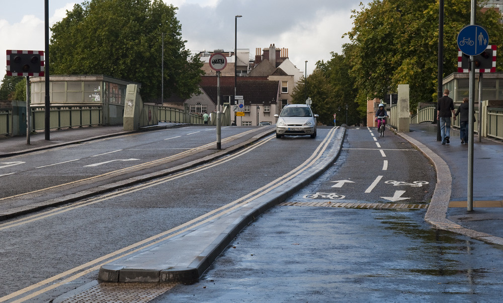
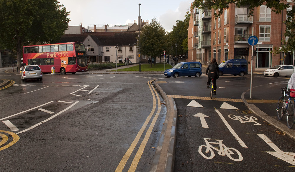
There are two types of shared use, with slightly different histories: pavements, and away-from-road paths. The big driving force behind away-from-road paths has been Sustrans. They tend to build ~3 metre wide shared paths — most of their surfaced rail trails are of this design — their reasoning being that “shared” is “flexible”: when numbers of one type of user or the other are high, and the other low, you’re not trying to deny the crowds use of a perfectly good empty bit of path. Sustrans correctly reasons that it is best for them to build ~3 metre shared paths, rather than trying to segregate users into two pieces of ~1.5 metre path separated with a white line as is sometimes the case, and as Sustrans tried on the Bristol Railway Path for a while. But only because Sustrans is an overstretched charity trying to get the most for their money, and who therefore don’t want to buy asphalt for more than 3 metre wide paths. Their choice is therefore shared or segregated 3 metre paths, and shared is the best of those options.

Passing
(cc) Edinburgh Cycle Chic, by-nc-sa

Better still is a 5 metre segregated path, like the route through Edinburgh University and the Meadows, but Sustrans are going for the cheap option and most councils have copied them.

Shared pavements have a slightly different history. So far as I can see, they are an invention of the early 1980s, with authority to construct/convert what it rather optimistically calls “cycle tracks” being introduced by the Highways Act 1980 (Cycling England had a document explaining it (PDF)). The 1980 Highways Act was a little before my time, so I tried to look up the original intention of the “cycle tracks” through the parliamentary debates. We know, of course, that Thatcher’s was an extreme pro-car and pro-road expansion government, famous for The Great Car Economy and Roads For Prosperity. My guess was that, if the government of the time even noticed that cycling existed, it probably saw it as a form of transport in terminal decline — something backward and even irresponsible. I was expecting to find that the purpose of shared pavements was not to enable or encourage the irresponsible act of cycling, but that they were a quick and cheap road safety measure intended to get bicycle users out of harms way for as long as it took the poor things to save up and buy a car of their own.

It was an impression partly supported by the BMA’s 1992 book on cycling, but I haven’t found much in which the Thatcher government puts its hostility to cycling into words — though it did slip out in this astonishing 1989 exchange in which Transport Secretary Paul Channon tells an Oxford MP that enabling cycling would be a bad thing for Oxford, given that the town has a car factory.

Rather, it seems that the government of the early 1980s had much the same attitude to cycling as the government now, and did much the same thing as the Labour government of the late 1970s, the Major government in the mid 1990s and the Blair government at the turn of the century. They saw that “cycling is booming“, paid lip service to it, published a statement of policy and then failed to devote anything near adequate resources to implementing the policy, relied almost entirely on local authorities to implement the policy and failed to ensure that the resources that had been allocated to LAs were actually going to be spent on interventions that work, until eventually everybody simply forgot that the policy had ever been declared. As the British Medical Journal put it, “The Government should stop its delaying tactics, with its stream of vapid consultative documents, and act to ensure that its citizens can travel safely and freely without hindrance by others.” To be fair, they did at least try to focus what little effort and funding they did devote to cycling specifically into better routes.

So the government and our representatives were probably no more and no less hostile to cycling than today’s. Perhaps, then, shared pavements weren’t meant as a simple get-them-out-of-the-way measure?

The 1980 Highways Act was very wide ranging — cycling was a tiny little bit, Section 65 of 345, and so cycling was only a tiny little bit of a debate and discussion. Part of that debate actually took place under the predecessor Labour government, in 1978, and the comments of under-secretary for Transport, John Horam, illustrate how that government was imagining the cycle tracks, mocking Dennis Skinner for suggesting that we should need or want to spend money on anything more than a white line on a footway:

Mr John Horam (Labour, Gateshead West)
On the question of cycle tracks and the clarity of the legislation, I again give the commitment that we shall make perfectly plain what is the law on this matter. It is within the powers of local authorities simply to draw a white line on a footway and turn at least part of it into a cycle track. We shall spell out all these details in the technical note.

Mr Dennis Skinner (Labour, Bolsover)
Worse than skateboarding.

Mr John Horam
I fear that we may be getting some dissension from my hon. Friend the Member for Bolsover, but I do not think that I shall draw him into the debate, because I know that he is strongly in support of this broad principle.

Mr Dennis Skinner
I support these principles, as one who owns a Raleigh with five gears. … I am intrigued about the business of having a white line down a footpath, with cyclists on one side. I can visualise myself travelling at 35 mph—when I am at my best—and a poor old lady walking down the other side of the white line. It seems to me that we need to look back a bit. Before the war, when we had other job creation schemes in hand not far from Clay Cross, the Government of the day—they were not of the present type, though I suppose that they were not all that much different—put forward a scheme for a cycle track between Clay Cross and Chesterfield, which stood on its own. If we are to launch out, I, as one who is not afraid to talk about public expenditure and mopping up some of the unemployed, am happy about advancing the case for proper cycle tracks at the side of the pavement, or somewhat removed from it, with none of this white line nonsense.

Mr John Horam
I take it that Clay Cross will be building large, expensive kerbs between cycle tracks and pedestrian facilities when it gets round to this, as no doubt it will. Everything happens in Clay Cross. No doubt the council will notice this new legislation and be eager to implement it at the first opportunity, so that the hon. Member for Acton and my hon. Friend can use the cycle track at Clay Cross when it comes into being.

So, again, the point of shared pavements was that they were cheap and easy — features that were especially important in 1978. The chair of the All Party Friends of Cycling Group agreed that cyclists were cheap and easy.

The new Conservative government didn’t debate cycling again before the Highways Bill became the Highways Act, but it did come up again in 1984 with the Cycle Tracks Act, which sought to simplify the bureaucracy for converting public footpaths to shared paths. It was primarily intended for urban alleyways, passageways and paths through parks and allotments — things like this and this. The story of the Act perhaps illustrates the attitudes and intentions for shared paths and pavements.

The Cycle Tracks Bill was introduced as a private member’s bill by the newly elected Conservative MP Barrow and Furness, Cecil Franks, though it was picked up and backed by the government. Franks, a local council man who was probably surprised to find himself in parliament representing a traditionally Labour seat, explained his motivation for introducing the bill: as a local councillor he had sincerely wanted to introduce more away-from-roads cycle routes, but the bureaucracy of seeking permission to “close” the footpath and then planning permission to “construct” the new cycle track — when in fact no physical works at all would be required — had been too great.

The Bill received cross-party support, and the stated intentions for all who spoke in the debates was to enable and encourage cycling. As Simon Hughes (Liberal, Bermondsey) said:

Liberal Members welcome the Bill. I feel confident, as I think do all hon. Members who have participated in the debate, that one result will be a reduction in the number of accidents, many of which can debilitate people and reduce their mobility for life, which are occasioned at present by cycle users, pedestrians and motorised transport users taking the same routes and getting in each other’s way. It is my belief that it should also result in an increased use of the bicycle throughout the country…

…His Bill is greatly welcomed by the Liberal party, as it is by all parties and by a large number of present cyclists and those who, as a result of it, will become cyclists. It is to the advantage of all.

If they thought that cycling was a means of transport in terminal decline that should be cleared out of the way for as long as it takes to die out, they certainly didn’t say so. Quite the opposite: starting from about 1979, it has been obligatory to start such speeches with “cycling has been booming in recent years…“.

There were only a couple of critical remarks.  Colin Moynihan (Conservative, Lewisham East) was critical of the narrow scope of the Bill, mentioning lack of design standards — and the lack of understanding from MPs of the need for them — for the shared pavements which had been introduced previously:

These questions are central to the consultation proposals behind the Bill and the importance that it gives to the safety of cyclists. The difficulties involved have in many ways been underestimated in the debate. The Cyclists Touring Club document on the Bill states that in the past cycle tracks have been extremely dangerous as well as unsatisfactory in other ways. It states: “There is neither priority nor protection for the cyclist at junctions from other traffic turning across his path or leaving minor roads, work entrances and private drives across the track. The majority of motorists, even if they notice the existence of the tracks, assume that they have priority over cyclists using them. It is usually difficult for a cyclist approaching a junction to ascertain the intentions of following motorists and inconvenient for a cyclist to stop and give way at every junction, no matter how minor, in order to be assured of no conflict. Queues of vehicles waiting to enter the major road from a minor one also invariably block the cycle track.” I have discovered that from my own experience. “Indeed, it is seldom possible to leave a cycle track sufficiently in advance of a junction in order to safely execute a right turn.” The greatest danger to cyclists certainly occurs at major junctions, especially roundabouts, where it is crucial that the highway code be observed. Other examples are bottlenecks such as bridges. Yet at these points cycle tracks often cease to exist. My hon. Friend the Member for St. Albans (Mr. Lilley) spoke of the difficulty of matching a completed cycle track with a similar stretch on the other side of the road. Cycle tracks may suddenly cease to exist, pitching the cyclist into a maelstrom of traffic at the most dangerous places. The Bill seeks to tackle those problems….

…Furthermore, the Cyclists Touring Club states: “Cycle tracks are frequently illegally obstructed and enforcement of parking restrictions has a low priority with the police. Defective vehicles are often moved on to a cycle track in order to clear the main carriageway even by the police themselves.” The maintenance of cycle tracks is given a low priority by local authorities. I hope that the bill will encourage local authorities to become more actively involved in the development of cycle tracks, and that there will be a move to greater local involvement in the development of cycle tracks….

…The Bill will achieve many of the CTC’s aims, including the banning of mopeds from cycle tracks and the banning of parking on cycle tracks, which has concerned many people for a long time. It will now be an offence to drive or park partly or wholly on a cycle track….

…The most important part of the process is the construction of the cycle track. There is no point in having cycle tracks that are a mass of potholes and inefficiently built, as they might serve only to add to the risks faced by cyclists.

and criticism of shared use from Gerry Bermingham (Labour, St Helens South) — albeit only from the “danger and discomfort for pedestrians” point of view and not also from the “not attractive for cycling” point of view:

As it is proposed that there should in some cases be tracks containing cyclists and pedestrians, I have reservations about the Bill. On my way to the House on Wednesday I was nearly mown down by cyclists coming up on the pavement behind me. That reminded me of the dangers of intermingling pedestrians and cyclists. There is much point, therefore, in the argument of the Royal National Institute for the Blind. If we allow the two to be near each other, there must be a segregating feature, not only for the blind but especially for small children using the footpaths.

It has been suggested that there might be a curb to sector the area. In my view, that would be the minimum solution, and I should not be happy simply with white lines, which are meaningless to the blind and are ignored to a large extent by young children who have not yet acquired the safety techniques, so to speak, of being with traffic.

But otherwise, members from all parties agreed that shared paths and pavements would be a good cheap and easy way to encourage and enable cycling, and didn’t see any need to bother themselves thinking about standards of design and maintenance.

And I don’t think that local authorities today think about shared use any differently: I don’t think there is any widespread idea that pedestrians and cyclists should be mixed — that it is an inherently good thing. Councils think of shared use, if they spend any time thinking about it at all, exactly as the MPs of the early 1980s did: it’s cheap and easy.

But even “cheap” is expensive when it’s money wasted on things that don’t work. So, while the intentions of thirty years ago might have been all good, the same can’t be said now that we have thirty years of experience with unattractive and ineffective shared pavements. If MPs today are serious about enabling and encouraging cycling they must retire these crap facilities in favour of infrastructure that actually works.

Crap facilities in LTN 2/08

Some folk think that things would be better — or less bad, at least — for cycling in this country if only LTN 2/08 “Cycle Infrastructure Design” were strictly followed. They see some good recommendations in the guidance, and perhaps a solution to the more bizarre makeshift crap facilities. A few go further, thinking that the document could actually be the basis for the better, safer, more attractive streets that would support a mass cycling culture.

I’ve explained why I think LTN 2/08 is not fit for the purpose of guiding cyling infrastructure design, but I don’t blame people for seeing the contents of LTN 2/08 as an improvement on the cars-only street designs and crap facilities that we have now. There really are good things in the guidance. Instructions for filtered permeability are given — though sadly at the level of individual streets rather than whole neighbourhoods. There are strong words about the use of “cyclists dismount” signs — though perhaps they could be even stronger. Replacing centre lines with wide advisory cycle lanes, tightening junction geometry, and other cycle-friendly traffic-calming solutions are suggested. The streets and cycle facilities in LTN 2/08 generally look more attractive than those that most of us are used to.

But at the same time, the document clearly encourages certain kinds of crap. There are two in particular that I feel like discussing: bus lanes and shared pavements.

On bus lanes, LTN 2/08 says:

6.1.1 Bus lanes are generally popular with cyclists (Reid and Guthrie, 2004).

A chapter is then devoted to bus lanes, giving, for example, guidance on designing out close overtakes by specifying lane widths, and specifying that cycle lanes can not continue through bus stops.

The cited source for the claim that bus lanes are popular with cyclists, Reid and Guthrie, is behind a paywall. But the abstract says:

Surveys and interviews carried out in Edinburgh, Hull, Derby and London found that riding in bus lanes (including contra-flows) was generally very popular with cyclists because it appeared safer and more direct than cycling in general traffic.

That is, lanes from which all motor vehicles except buses are banned are more popular than lanes which are full of trucks and fast cars. Bus lanes on busy roads are something that cyclists use to get by, they are not an aspiration and they do little to reduce the barriers to would-be cyclists switching their travel mode. In fact there are many problems with bus lanes: they’re shared with some of the biggest, most intimidating and most polluting vehicles on the road, constantly stopping and starting; they’re shared with impatient and frequently hostile taxi drivers (though there is no good reason why they should be, and this could easily be remedied with a change to the rules if only politicians were willing to make it); they do nothing to solve the junctions problem; they don’t solve any problems outside of their hours of operation or the hours of parking restrictions; and they suffer from much the same left-hook problem as cycle tracks — and one that is far more difficult to solve with engineering than that of cycle tracks.

More important are the things that LTN 2/08 has to say on “off-road cycle routes”. Off-road cycle routes should mean cycle tracks and paths. But little in LTN 2/08 comes anywhere close to resembling proper cycle tracks. It’s all shared paths — the basic unit of the crap facility. Indeed, the first line of the chapter on off-road cycle routes prescribes these shared pavements:

8.1.1  Off-road cycle routes almost invariably accommodate pedestrians too.

(The switch from prescriptive to descriptive language is a bit bizarre. Perhaps the authors knew of the problems with shared pavements and couldn’t quite bring themselves to explicitly endorse it, but were prevented from recommending anything better? The document could equally state that cycle routes are almost invariably blocked by ridiculous obstacles and “cyclists dismount” signs. But it doesn’t, it strongly discourages such things. This is a prescriptive document therefore this is a de facto prescription for shared pavements: that is how engineers are going to use it.)

I’ve already discussed the damaging endorsement of “dual networks”, and the idea that standards can be compromised on cycle routes because Real Cyclists will naturally always prefer to ride on the roads. It shows up right from the start, in the introduction:

1.3.8: inexperienced and/or leisure cyclist – may be willing to sacrifice directness, in terms of both distance and time, for a route with less traffic and more places to stop and rest;

And it can be found again, in the section on off-road routes. After a good start on design speed, it explicitly recommends compromising on quality, all because it can’t imagine a cycle route having a separate footway:

8.2.1 On commuter routes, cyclists usually want to be able to travel at speeds of between 12 mph and 20 mph, preferably without having to lose momentum…

8.2.2 A design speed of 20 mph is preferred for off­road routes intended predominantly for utility cycling…

8.2.3 Where cyclists share a route with pedestrians, a lower design speed may be required. Routes with design speeds significantly below 20 mph are unlikely to be attractive to regular commuter cyclists, and it may be necessary to ensure there is an alternative on­carriageway route for this user category.

There are certain situations where a shared path may be acceptable. Outside of urban areas, where usage is low, for example. And shared use can be appropriate if applied not as a route but at destinations, to help get the final few yards to the parking. It is rarely the right way to build a through route in urban areas where usage both on foot and on bicycles will be high, leading to conflict. A manual should be explaining such things. This one isn’t, it’s just endorsing low quality shared paths — for that’s how it will be, and has been, interpreted — whether it intends to or not.

The formula for crap facilities continues where width is discussed:

8.5.2 A minimum width of 1.5 metres is recommended for a one-way cycle track. The minimum recommended width for a two-way cycle track is 3 metres

8.5.3 Where there is no segregation between pedestrians and cyclists, a route width of 3 metres should generally be regarded as the minimum acceptable, although in areas with few cyclists or pedestrians a narrower route might suffice.

These are, of course, minimum widths, and they are indeed acceptable minimum widths where, say, there is a short section where a pre-existing, immovable and unworkaroundable building or geographical feature makes the desirable width impossible. But they’re rarely appropriate over sustained distances, except perhaps, depending on the exact circumstances, on the lowest trafficked rural routes — and even then, routes that are predicted to be low usage do not always turn out to be so. That these are merely the minimum widths for low usage routes is mentioned in the document, and the authors can not be blamed for their misuse — though I would like more to have been said about what the actual desirable widths are.

But misused the widths are. Every new relief road and shopping centre distributer and every big new road submitted to the DfT for funding last year — even those in so-called “cycling cities” — has a 3.0 metre bidirectional shared pavement on one side.

Obviously the problem here goes far wider than just this document alone. The way that at least some local authority engineers and consultants approach this stuff is revealed in this delightful discussion on those other crap facilities — Advance Stop Lines:

My colleagues and I have been looking through LTN2 /98 and its more of a compendium of How Not To Do Traffic Engineering than anything else. I would hope that Figure 9.4 was swiftly removed from street – in fact I have to wonder why DfT even published the picture in the first place! Another one is Figure 7.2 which invalidates the double yellow lines – and thats given as a good example? Come on!

These are figs 9.4 and 7.2:

There are other marvelous comments in that thread…

I have NEVER seen the point of ASL across full width when a R/T is NOT permitted (and some even show this across three lane approaches.

I agree re the suggestion that 5 metres max depth is excessive. This measurement is applied as a standard in Edinburgh and I have queried the use of such a distance in a city where under 1% of daily commuters are cyclists.

Obviously the content of LTN 2/08 itself is not even half of the problem when highways departments are populated almost exclusively by non-cyclists who think that the worst thing about the cycling infrastructure guidance is a non-standard bicycle-shaped red traffic light and that advance stop boxes don’t need to be deeper than a truck’s blind spot, and when politicians are reinforcing that cars-first culture by pursuing fanciful programmes of “smoothing traffic flow”. But fixing the guidance looks to me like the easiest step in the change that is needed. If things are going to continue to be built by a formula with no understanding of the theory, we should at least make sure that the formula is right.

(Thanks to Mark and Paul, who helped to annotate the good and bad in LTN 2/08 a few months ago — though I don’t claim to speak for anybody other than myself in this post.)

Shared-use facility of the month

Riding up to Waterloo recently, I spotted a wonderful collection of pavement obstructions — roadworks signs, a fast food kiosk that takes most of the width of the footway, and A-board advertising the fast food kiosk just in case you hadn’t spotted the kiosk itself, and a fixed shared-use cycle/footway sign, designating this pavement as a place to ride your bike.

It’s not entirely clear from the sign’s position and jaunty angle whether the shared-use applies to the narrowed pavement outside the kiosk, or the even narrower pavement alongside the Charing Cross railway arches.

(distorted by ultra-wideangle lens)

The latter could be a useful route up to Waterloo (up the ramp in the distance on the left) avoiding having to go through the roundabout and bus station (beyond the traffic lights on the right), though it would make a lot more sense just to add “except cycles” to the “no entry” sign on this little-used one-way street.

But I realised later that it’s probably to take you up to those traffic lights, which control a toucan crossing allowing one to make the right turn into a quiet side-streets route without having to pull across two lanes and wait in the middle of the road for the oncoming traffic.

There are dozens of ways this could be improved, by moving the kiosk out of the way, moving stop-lines back on the oncoming carriageway and on the no-entry side-street, and having a proper bit of cycle track leading into the crossing. Just as Haarlem patched the ugliest bits of this ugly road, one can imagine a great many far superior ways to deal with this crossing.

But anything you build to serve this crossing is always going to be far from satisfactory because the entire concept is wrong. There should be no need to cross here at all because the recommended cycle route shouldn’t be meandering down little side-streets like Exton Street. If you want people to cycle, you need to give them an attractive, direct, easy to follow route, that doesn’t waste their time with constant changes of direction and checking of signs. Main roads like this need a complete rebuild — as they tend to get every few decades anyway — but with proper thought and planning. It’s not difficult to see where the space can be taken from vehicles (and kiosks) on this road of bloated traffic lanes to provide high quality dedicated space for cycling.

Until that happens, trying to route cyclists through cramped and crowded bits of pavement kinda makes TfL and Lambeth look like a bunch of idiots.

A death in Hucknall

A funeral takes place in Nottinghamshire today. The Hucknall Dispatch reported on Sunday:

A LARGE congregation is expected to pay its respects at the funeral of a well-known Hucknall grandad who was killed in a tragic road-accident.

Cyclist Alan Davies (58), of Polperro Way, died after he and an articulated lorry collided on Watnall Road, Hucknall, near the Rolls-Royce site on Tuesday September 27 at 7 am.

His funeral is scheduled for Hucknall Parish Church on Market Place at 2.45 pm next Thursday (October 13). Cremation will follow at Mansfield Crematorium before a get-together at The Hucknall Empire pub and restaurant on Morven Avenue, off Beardall Street, from 4 pm.

As well as his wife, Dorothy, Mr Davies leaves three children — Danny (38), who now lives in Huddersfield, Kimberley (29) and Charlotte (28). He also leaves five grandchildren.

His family and friends have been devastated by the tragedy.

A man with strong connections to local football, Mr Davies was well known in Hucknall. He stood as an Independent candidate in the Hucknall West ward at the Ashfield District Council elections earlier this year.

A former fitter at the now-closed Linby Colliery, Mr Davies was also an avid writer of poetry and an expert on Lord Byron.

His family say he “had Hucknall at his heart”.

An inquest into Mr Davies’s death was opened and adjourned at Nottingham Coroner’s Court on Tuesday.

As reported in the Dispatch, Mr Davies died 30 years after his five-year-old son, Julian, was killed in a road accident on Annesley Road in Hucknall.

It was the top Google News report when I was looking for coverage of the Hucknall “Town Centre Improvement Scheme”, a Development Pool project seeking £8.5 million to pedestrianise the town’s High Street… by demolishing eighteen houses to make way for a bloated new “inner relief road” linking the two streets named in this news item. I have never been to Hucknall, but Nottinghamshire must have a pretty low opinion of the town if they think that this an “improvement”.

It’s another of those roads that council officers have been drawing and re-drawing for fifty years — and it wouldn’t look out of place in the 1970s. Perhaps the current head of highways drew it himself, as a lad, in a junior position decades ago?

Hucknall already has a bypass, the A611, built in the early 1990s. It only has a High Street traffic problem now because it failed then to do anything to prevent the town centre being used as a ratrun.

Like all these Development Pool plans, it all sounds very nice in the sales pitch — all this new walking and cycling and public transport provision:

1.2 What are/were the primary objectives of the scheme? Please limit this to the primary objectives (ideally no more than 3) the problems to which this scheme is the solution.

• To promote the renewal and regeneration of Hucknall town centre and create an attractive and prosperous retail centre;

• To improve the quality of life in and around the town centre by enhancing the quality of environment for pedestrians, whilst providing cycle facilities in the vicinity of the town centre, and improving links between different parts of the town and achieving greater integration with the tram/rail interchange;

• To make best use of highway assets by reducing levels of traffic congestion through Hucknall town centre and enhancing the status of public transport in order to encourage a modal shift away from the private car and improve bus service

You wouldn’t even guess that most of the money will be spent on demolishing 18 houses and building a big new town centre road, to the most walking and cycling unfriendly design possible for a road of its class.

“Enhanced pedestrian and cycle facilities together with environmental improvements throughout the town centre will be provided.”

What are those “enhanced” pedestrian and cycle facilities? A 3.0 metre shared pavement has been specified. A new source for the Facility Of The Month, perhaps. Maybe there will be a while line down the middle, giving pedestrians and cyclists each their 1.5m share of the pavement.

Three metres is the bare minimum for an adequate dedicated bidirectional cycle track. Anybody who proposes in an official document that cyclists and pedestrians share a 3.0m pavement in a busy town centre should have their bid laughed out of the Pool. There should be legislation stating exactly that: setting proper standards and disqualifying the bids of councils and agencies who don’t meet those standards. But what’s this?

Are you proposing any changes of scope from the scheme as described in Section 1? If yes, please describe in detail the changes you are proposing. Please also attach explanatory maps, diagrams etc. as appropriate.

• Localised narrowing of the 3m cycleway/ footway. This would deliver a cost saving of £100,000 as a result of reduced land take and retaining wall construction

I don’t take the linking of a personal tragedy to a political campaigning issue lightly. But tragedies like these are entirely predictable. When you build big roads and unusable “facilities”, and send articulated lorries through town centres and residential neighbourhoods, people are going to die. Nottinghamshire have killed a man and they plan to kill again — with £8.5 million of our money, if they can get their hands on it.

The DfT are accepting comments on Development Pool proposals until the end of tomorrow, Friday, on development.pool@dft.gsi.gov.uk.

Big roads, crap cycling and bendy buses in the Development Pool

While London’s attention is turned to Blackfriars Bridge, those blissfully unaffected by the bumbling buffoon Boris* might like to take a look at the 45 proposals that councils around England have submitted to the DfT’s Development Pool in the hope of being picked for a share of the current £630 million available for local transport projects.

Heads of council transport departments and engineering consultancies have dusted off the bypasses, relief roads, distributors and links that they have been drawing and re-drawing, submitting and resubmitting for funding for fifty years.

Look at your local area in the Development Pool and you’ll find them all there. They’ll be called something like “town centre improvement”, “bus rapid transit”, or “cycle route enhancement and congestion relief package.”

Things like the Weston-super-Mare package, which will provide better bus services and enhanced cycle routes, by, erm, widening town centre roads and ensuring that they have substandard and probably unusable shared pavements alongside.

Of the Cross Airfield Link Road, proposed to open a large brownfield site to light industrial and retail developments,** the Weston package says:

The approval is for a single carriageway road 2.4km in length, four roundabout junctions and parallel shared-use foot and cycle ways. The proposed road is 7.3m wide single carriageway. A 3.0m wide segregated shared pedestrian and cycleway will be provided along the northern side of the new road with a 3.0m footway along its southern edge. Both the cycleway and the footway will be segregated from the carriageway by 5.0m verges which are to be planted with trees to create a boulevard along the road’s length. The scheme design includes Toucan crossings in strategic locations.

This sort of stuff should be illegal — I mean that, actually legislated against. Proposing a shared pavement as a transport route in a built-up area should mean automatic rejection from the Pool, pending a suitable revised design. Three metres should be the bare minimum width requirement for a two-way dedicated cycle track on busy roads like these, where large trucks are expected, and even then the council/agency should have to provide a very good explanation for why a 4.0m track or a pair of 2.5m unidirectional tracks would be unreasonable. Weston are proposing to spend our money on a future facility of the month, and that should be against the law.

There is a pattern to the Development Pool proposals. Another Westcountry project is the “South Bristol Link”. It’s a Bus Rapid Transit route, and definitely not the South Bristol Link Road, the extension to Bristol’s southern bypass that the council has been drawing and re-drawing, submitting and re-submitting for funding since the sixties. It just happens to be a road, and to follow the route of the South Bristol Link Road. But it has bus lanes, which makes this a Bus Rapid Transit project, and definitely not the same old bypass. Bristol has grown since the road was first proposed, but the route was set aside, leaving a strip of undeveloped land surrounded by housing. Here’s the artist’s impression of the Bus Rapid Transit system:

Look at that lovely 3.0m shared pavement — in this case divided into equal shares of 1.5m footway and 1.5m bidirectional cycle track. Doesn’t it look so inviting, riding against traffic, alongside the car parking bays, in a space barely wide enough for one bicycle. One bicycle is presumably all that the council are expecting: there is no provision for two bicycles travelling in opposite directions, or travelling in the same direction at different speeds. The council will no doubt seek a solution to that problem if and when it ever arises.

It’s a classic British road mockup. Hide all the cars and clutter and put unnaturally large pedestrians and cyclists in the foreground. The road would be carrying thousands of vehicles per day, swelling with induced demand, but here it’s all free flowing, and just a single homeowner parks a car in their neat free parking bay, gift from the council. Perhaps all the other cars are parked in the city centre because neither a 1.5m bicycle track nor a bendy bus to an edge-of-town park and ride interchange are attractive methods of getting to work?

A 1.5 metre bicycle track will be of no use to anybody. The parking bays will, if you let them, fill with second and third cars, and spill out over the drop kerbs and green spaces. Within a few years the city will discover, to everybody’s surprise, I’m sure, that there is limited demand for a bus between suburban housing and an edge-of-town park and ride interchange, and the bus lanes will quietly be turned into general traffic lanes.

I’m really quite embarrassed for Bristol, having praised them for exceeding our (low) British expectations on Redcliffe Bridge. Seriously, what the fuck, Bristol? “The country’s premier national and international showcase for promoting cycling as a safe, healthy and practical alternative to the private car for commuting, education and leisure journeys.” Bristol’s “cycling city” status clearly hasn’t really sunk in for the highways engineers, who plainly have no experience of cycling or how to provide for it, but who confidently give it a go anyway having read something once in an instruction book.

The city council are cutting hundreds of jobs, and I think I’ve spotted where a few of them of them could go.

While cutting those jobs, the city is seeking £43 million for this bypass Bus Rapid Transit line. I think the Cycling City team could use the money far more profitably, retrofitting the city’s existing big roads with wide, fast, direct, prioritised, attractive tracks, and could never support Bristol throwing the money away on the South Bristol Link. But even for an urban road project, and even leaving aside the contemptible crap cycle facilities, this is an especially bad scheme. The one potential benefit of a bypass is to have a designated road on which to push traffic from city streets. But to capture that benefit you have to reclaim those city streets immediately — make it unattractive to drive on them for anything other than essential property access and loading — otherwise people will just find new ways to fill the old streets with more ridiculous car journeys. With a southern bypass Bristol could close ratruns through the southern suburbs; take back space on the main southern arterial roads — the A38 through Bedminster, for example — for the pedestrians and cyclists who spend more money in the shops along them; it could even close some more of the inner ring road. Bristol failed to capture those benefits when it previously built big bypass roads, on the northern and eastern fringes, and it would fail to capture any potential benefits of a southern bypass, proposing to make it a little bit less attractive to drive only on a couple of residential streets and a country lane:

Take a look at your local schemes on the map. There are potentially worthwhile projects in the pool too, like rail upgrades and even reversing railway closures. More has been written about the bids by Sian Berry and George Monbiot. The DfT are soliciting comments on development.pool@dft.gsi.gov.uk, deadline TOMORROW, Friday — though I’m not sure why, and whether anybody will ever read them.

* but we’re all affected, sadly, due to London’s unfortunate influence over the nation.

** it’s actually one of the least indefensible of the new roads, and one of the least bad sites for such developments, being on brownfield located alongside a railway and within walking and cycling distance of the town’s population and railway stations. I’m sure they will fail to make good use of all that potential, but it’s still progress over road-only out-of-town greenfield sprawl.

The Brunel Mile

Like most British cities, Bristol has a big inner ring road. It crashes through neighbourhoods of medieval houses and 1970s concrete office towers, and it thunders past landmarks from Brunel’s Temple Meads Station to England’s largest parish church, St Mary Redcliffe, a fortress of fast cars and pedestrian cages cutting the old central business district from the rest of the city.

But it’s not a ring road. The ends used to meet: from Redcliffe church it continued west over the bascule bridge and cut diagonally through the run-down Georgian Queen Square. Twenty years ago, Queen Square was taking 20,000 vehicles a day, including 1,000 buses. No wonder it was run-down. The council got rid of the vehicles, all of them, and restored the Georgian square, now a calm but popular little park. It remains one of the few notable examples of undoing 1950s-80s urban motorway mistakes in the UK, and it happened at the same time as one of the last of the mistakes, the M11 link, was being driven through Leytonstone.

The restoration of Queen Square left a bizarre stub of dual carriageway on Redcliffe’s bascule bridge (orange, below the ‘I’ in ‘Bristol’), carrying a tiny fraction of its designed capacity. When I was there in the spring I noticed that they had finally brought the builders in to do something new with the bridge. Here’s the finished £130,000 piece:

I was a bit disappointed — I’d been expecting them to move on to the other carriageway once this one was complete, for a pair of unidirectional tracks, but they’ve just gone for a bidirectional track using a single traffic lane, which apparently isn’t much help to the gentleman who is using the opposite pavement. Still, the one track is not an unusable width.

The reason they’ve gone for a two-way track here is that the council are not thinking in terms of fixing individual isolated streets, but nor have they yet got to the stage where they can think in terms of a network. If this were part of a network, you would have tracks on each side linking up to more tracks around the other big roads, as well as to the calmed low-traffic streets around here. Rather, Bristol is currently thinking in routes — that’s all they can do with the small pot of money they were given to become a “cycling city”. This is one of half a dozen routes that the city was able to create with the project.

It’s the “Brunel Mile”, a very direct route between Temple Meads Station to the bars, restaurants, and museums of the old harbour. Sadly, this short section over the bridge is probably the highest quality section. The cycling city website, Better By Bike, produced a video of it:

Lots of shared use plazas, parks, and pavements. That’s fine for access — making it possible to keep riding the final yards to the destination — but shared use doesn’t really make for an attractive through route, especially when it runs straight through a set of tables laid outside a cafe. Bristol already had a lot of shared use squares and parks — Bristolian pedestrians and cyclists seem to be able to get along without one interpreting the mere sight of the other as a near death experience. Little, if any, of the shared use in this video is new, but previously it was designated as shared use more because there was no reason to ban bicycles from those areas, rather than because they made useful through routes.

Bicycles have at least been given priority, and a raised table, where the route crosses Welsh Back, from Queen Square onto the bascule bridge — though there aren’t many other examples of this arrangement in the Westcountry, so it might take motorists a while to work out that their “give way” markings aren’t a mistake (notice that the producer of the video clearly had little confidence that the white van was going to give way at 0:57). And there’s no other priority crossings on the route — only some grey-green paint on Prince’s Street, and toucan crossings with very long waits on three different branches of ring road before finally reaching Temple Meads.

This is not a toucan.

Clearly the cycling city team were going for a cheap option — spreading their little grant thin over as many routes and projects as possible, and reusing as much existing infrastructure, whatever the quality, where they could. But when it came to a gap in their route, where no existing infrastructure could be commandeered, they’ve taken the time and money to do it right: they’ve taken a traffic lane out to built a proper usable cycle track, rather than dump people on a dual carriageway with the buses. Perhaps it’s not quite as much space as would really be desirable, but it’s enough, and with priority over the minor roads. And they did it, so far as I can tell, without being asked — without the campaign and the fight that was required in Camden.

With real funding, I think Bristol could do great things. The cycling city grant must have brought some of the right people in. With the grant all spent, I fear they will have been sent on their way.

The local rag doesn’t like it, but I always got the impression that the Evening Post was pretty irrelevant.