Readers with no interest in the nerdy details of UK railways can look away now. This post is one very long, tedious “actually I think you’ll find” reply that I didn’t have time to make fit into a tweet.
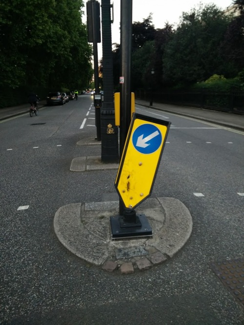
So the railway electrification programme has been cut back, with the entire Midland Main Line electrification scrapped, plus relatively small chunks of the Great Western (at Swansea) and Northern (at Windermere) projects.
And predictably enough, the worst takes roll in trying to blame this on HS2, from people who will believe absolutely anything you say against the high speed project. These are terrible takes. And they’re a problem, because these are the kind of terrible, childishly simplistic takes on complex policy issues that stop you doing anything useful about them.
I can’t claim to be an expert on the situation with electrification — take everything I scribble here with plenty of salt, and factcheck it before you go citing any of it — but I know it’s a bit more complicated than almost any of the takes on twitter. So, since you asked, here are some alternative takes for you, which I hope might help to shed the tiniest bit of light on just the surface of that deep complexity.
Electrification hasn’t been cut
The first thing you need to understand is what has actually happened, and what Grayling’s announcement is tiptoeing around. The budget for electrification hasn’t been cut to pay for HS2 because the budget for electrification hasn’t been cut. It has been massively overspent.
Railway investment is planned in 5 year chunks (the announcements are happening now because now is the deadline for DfT to send their draft investment plan for the next 5 year period to the relevant organisations for comment).
In the current 5 year period, 2014-19, Network Rail were asked to electrify a lot of things:
- Great Western (GWML) from Paddington to Oxford, Bristol and Swansea, including Thames Valley commuter lines;
- Midland (MML) to Nottingham, Sheffield and Corby
- The main TransPennine line between Liverpool, Manchester, Leeds and York, plus associated Northern lines around Liverpool and Manchester
- A couple of comparatively short commuter lines elsewhere — London Overground’s GOBLIN and Birmingham’s Chase Line
- (Plus a lot of Scotland’s Central Belt. That’s separate, devolved to Scotland, but it’s relevant later.)
Network Rail gave an estimate for these jobs, the government liked it and made the funds available.
So Network Rail got to work on the GWML and immediately began massively overspending and falling behind schedule. So the budget hasn’t been cut. It’s just that Network Rail has spent all of the money before it has delivered even half of what it was supposed to deliver.
This wasn’t even really about electrification
The next thing you need to understand is that electrification is just one part of a much bigger, more complicated modernisation plan which is primarily driven by the need for new trains. It’s no coincidence which lines were chosen for electrification: they’re the ones that need the most new trains, or which maximise the opportunity to bring in new trains so the current ones can be sent elsewhere.
The country already has a chronic undersupply of diesel trains, because we haven’t bought any new ones in years despite passenger demand growing. But the situation is about to become dire, because deadlines are looming for the mass withdrawal of a substantial fraction of the fleet.
On the GWML, and a few other parts of the network, the Intercity 125s are reaching 40 years, a heroic service for an intensively used intercity train. They’re brilliant but they can’t keep going forever. Meanwhile, in 2020, new accessibility regulations come into force. Lots of trains won’t be compliant with the new law, so they either need expensive modifications, or withdrawal. Since nobody is going to waste money modifying the hated 1980s Pacers, those are off for their long-overdue trip to the scrapyard.
So, 10 years ago, people started realising we were going to have a rolling stock problem and something needed to be done about it. They could have just bought a load of new diesel trains. But somebody looked at the problem strategically, and the case was made for killing many birds with one stone. Electrify some lines and then you can solve the rolling stock problem with cheaper to buy, cheaper to operate, faster, cleaner and greener trains.
This was an excellent plan.
The plan all depended on the electrification happening in time for the 2020 deadline, so that a complex cascade and shuffle around of fleets could happen. New electric commuter trains in the Thames valley, for example, will displace Paddington’s diesel commuter trains to Bristol, so Bristol’s can in turn replace the condemned Pacers elsewhere.
Now those timelines are all fucked, so a load of new diesel trains have had to be ordered anyway.
Dropping the Midland Mainline is a good thing
When you see that this is a rolling stock project, dropping the MML — and Swansea and Windermere — at this point makes perfect sense. The MML has a relatively small fleet of intercity trains — most of them relatively new — and no diesel commuter trains to displace for use elsewhere. Rushing to try to electrify it will do relatively little to solve a rolling stock problem. Effort needs to be focused on finishing the Thames Valley and Northern areas, where there are the greatest number of diesel trains to release and cascade per mile of electrification, before 2020.
That’s not to say that we shouldn’t electrify MML, only that it doesn’t make sense to do it right now, when there are obvious higher priorities.
Slowing down electrification is a good thing
This mess all happened because we bit off more than we could chew — or rather, Network Rail was asked to do, and agreed to do, more than it could possibly do at once. The last time Britain did any substantial amount of electrification was a quarter of a century ago, and suddenly we decided to try to do 6 or 7 projects simultaneously.
That led Network Rail to make a lot of mistakes, spread themselves too thinly, and made it a seller’s market for their suppliers and contractors.
One of the big problems that has been encountered is that electrification is interdependent on other projects, like re-signalling in the Bristol area and rebuilding Oxford station, which have encountered their own problems. Slowing down could enable projects with dependencies to be delivered in a more rational and coordinated way. That would be particularly important on TransPennine, where there are still projects in development to improve line speed and capacity.
The significance of Grayling’s announcement is that he didn’t cancel the rest of GWML, TransPennine and Northern or GOBLIN. That implies that finishing these projects will be what Network Rail gets asked to do in the next 5 year period — 2019-24 — if they don’t get finished in the current one.
That doesn’t mean that Swansea and MML will never happen, but they won’t happen before 2024.
We’ve recognised that everything can’t happen all at once in 5 years, and asking for it all to happen at once in 5 years is a recipe for disaster. Dropping some projects should make the others more secure.
But you’ll still need to fight for them
That said, it’s still a very bad sign that the projects have been explicitly cancelled. There’s nothing to force Grayling to say cancelled. He could have said: there’s only so much we can do at once, so MML, Swansea and Windermere are shelved for this period and we can look at them again the next time we do this funding specification exercise in 5 years time. Instead he chose to call them cancelled.
That’s because Grayling, and perhaps equally importantly the chancellor, don’t get railways.
Take a look at their policies and track records and it won’t take you long to find Hammond’s notorious question about why trains don’t give way to cars at level crossings, or Grayling’s clueless playing politics with London’s suburban rail.
Blaming HS2 would let them off the hook, and they both probably want an excuse to cancel that project too.
But the real problem, and potential solutions to all this, is with the system
We concentrate power centrally in a few hands, and then change the leadership frequently through reshuffles and changes of government. The recent fashion for electrification rose and survived due to support from Transport Secretaries and Chancellors like Andrew Adonis, George Osborne and Patrick McLoughlin (who’s constituency just happened to be on a branch of the MML).
It’s a real bugger that in the game of musical chairs, Grayling and Hammond happened to be in the seats when the music stopped for this crucial phase in the funding cycle. We can at least take comfort that neither will be in the same seats in 5 years time when this exercise next happens.
But we will still be planning investments in a stupid and wasteful way.
With the last major electrification projects having been quarter of a century ago, to make the current projects happen we’ve had to rebuild our expertise, retrain our workforce, and rebuild our supply chains. That’s yet another of the reasons why so much has gone wrong and gone overbudget. We had huge start-up costs. We didn’t have the expertise or information to make accurate estimates. Rookie mistakes were made. And the politicians set Network Rail up for failure by ordering them to do 20 years worth of work in 5 years, because that’s the maximum horizon politicians work to.
Now we’ve flipped political leadership and policy, and we risk losing the expertise and supply chain that has just been built up from scratch, so next time electrification comes back into fashion, as it surely will, we’ll do it all over again.
Slowing down electrification, could be a great opportunity to do it better, more rationally. While the 2020 big bang deadline for rolling stock retirement has now been solved by ordering new diesels and bimodes, there will be a continuous trickle of other diesel train fleets reaching the ends of their operational lives over the subsequent years — alongside continued growth in passenger demand, if current trends continue. It would make perfect sense to continue, at a slower but more consistent pace, a rolling programme of electrification to pave way for electric trains to replace fleets as they reach retirement age.
With the security of a rational, long-term plan, we could retain a committed workforce which builds up the experience and expertise to do an efficient and competent job, and to innovate in delivery. We could support a supply chain that invests in a long-term steady return, instead of handing out a brief bonanza and leaving them bust. And we could plan delivery alongside dependent projects.
(Scotland looks to be slightly closer than England and Wales to having such a plan, with an ambition to electrify their remaining commuter and intercity lines in a 2 decade rolling programme, though even that will be at the mercy of future Scottish ministers who may not share the ambition. Alas, we don’t even have the ambition, and will remain stuck swinging between ideological extremes until somebody fixes the system.)
Blaming HS2 isn’t going to fix any of these underlying issues that stand in the way of electrification continuing.
Electrification’s failures are exactly why HS2 is happening
Your final hot take: everybody complaining that HS2 is to blame for this is clueless not just about electrification but also about what HS2 does.
Electrification is being cut back because it’s massively overbudget. All those people like Richard Wellings at the IEA pulling cost estimates for HS2 out of their ass? The overruns they invent are nothing compared to the 300%-500% overrun on the GWML.
And that just cements the case for HS2. Whatever you think of HS2 (and I say this as somebody who certainly wouldn’t have put it as #1 transport capital priority, or chosen many of the design specifications it has been given), the fact we’ve seen time and time again is that trying to upgrade and add capacity to existing transport routes — by modifying their old infrastructure while trying to work around a live, intensive service — is massively more expensive compared to building something brand new for the equivalent capacity added, and is substantially more likely to run massively more overbudget than the newbuild.
Just as electrification was really a rolling stock replacement programme, HS2 is similarly not what it seems. HS2 is not a high speed intercity programme. It’s a getting intercity trains out of the way programme. The West Coast Mainline out of Euston, MML out of St Pancras, and East Coast out of King’s Cross all need more capacity. There is unmet demand for more local rail commuting in the cities served by these lines, for more regional trains to and between towns on them, and for more freight on the railways. There isn’t capacity to meet that demand because mixing frequent-stopping commuter and regional trains, lumbering freight trains, and high speed intercity trains makes for an inefficient use of a railway line. HS2 creates a disproportionately large amount of capacity for local and regional services by getting the intercity trains out of the way.
People who argue that what the railways need is better local, regional and commuter services instead of faster intercity trains need to explain how those services will be possible without HS2. The only alternative is by making extensive modifications to 3 different Victorian mainlines, on a scale no smaller than HS2 itself, while trying to work around a live, intensive service. The fuck up of electrification has only made HS2 look even more like the preferred option over the terrifying prospect of that alternative.